A walk featuring farm relics, natural bush and motor racing history.
This short but sometimes strenuous walk features much scenery to keep you interested and motivated to keep walking.
The description is accurate except for the distances. The turn-off to Happy Valley Track is almost a kilometre along the track instead of 500 metres.
The informal track, the Orchid Trail, to the is just past a rehabilitation area marked with a deteriorating sign, but the track is well made and easy to see.
The Orchid Trail has a number of diversions and all lead to Rob Roy Road. One winds around a considerable extra distance and should be avoided if you’re short on time.
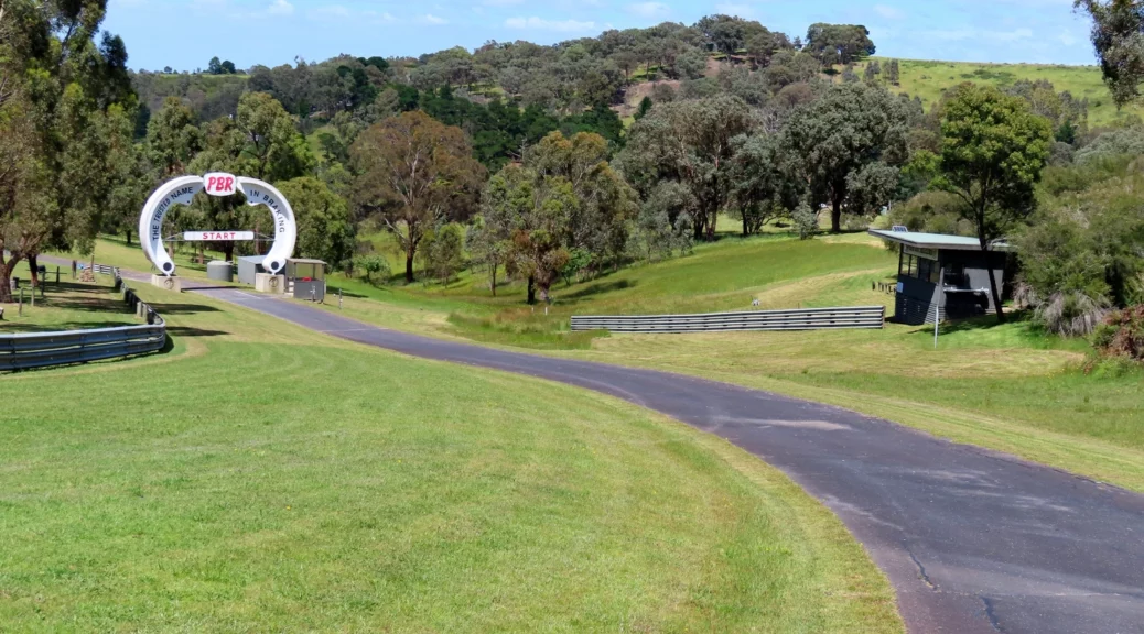
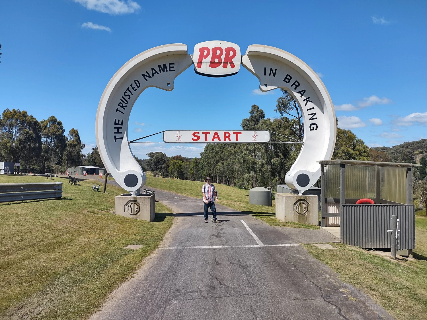
Turning left onto Rob Roy Road takes you past the hill climb finish obvious with the many car tyres to stop wayward racing cars. There is a track which runs roughly parallel to the Hill climb and connects to Clintons Road which leads back to the car park.
Officially the track is authorised access only, but if you’re discrete and respectful of other’s property having a walk along the track shouldn’t upset anyone.
So having an interest in motor racing and since there was no racing event on we had to have a closer look at the track, and get a photo of the PBR brake shoe arch over the start.
Walking past the course start and continuing down the road takes you to a gate to be jumped and then onto Clintons Road to return to the car park.
Walk Description
From the Eltham Environs Walking Group, walk 48M
Commences at the corner of Clintons Rd and Kangaroo Ground-Yarra Glen Rd, which is just prior to the Sugarloaf Dam turn-off. Cross Clintons Rd, and walk east along the informal track parallel to the main road for about 500m, then turn left to meet the main Happy Valley / One Tree Hill path.
Turn left, and walk until an informal track off to the left is reached (about 1.5km ). This is just past an area fenced off on the right for re-vegetation. Turn left, and follow this track, crossing Happy Valley Creek, then climbing a moderately steep hill to the top of the Rob Roy Hill Climb.
Turn left, walk down the hill, then left again into Clintons Rd, and back to the cars. Note that when this walk is undertaken in the opposite direction, the track used in the past that descends from the top of the Rob Roy Hill Climb to the valley below is difficult to discern near the base.
A more clearly defined, though longer track can be used as an alternative.
Walking Map
Max elevation: 268 m
Min elevation: 116 m
Total climbing: 1351 m
Total descent: -1351 m
Total time: 02:10:28
Further Reading
. Its origins go back to 1935, when representatives from the then Light Car Club of Australia inspected the property known as Clinton's Pleasure Grounds, with a view to establishing a suitable venue for the hillclimb meetings.") |
Home – Rob Roy HillclimbAt the time of its construction, Rob Roy was one of only three bitumen surfaced purpose built hill climbs in the world, the other two being Shelsley Walsh and Prescott (UK). Its origins go back to 1935, when representatives from the then Light Car Club of Australia inspected the property known as Clinton's Pleasure Grounds, with a view to establishing a suitable venue for the hillclimb meetings. |
 |
MGCC – home pageThe M.G. Car Club, Melbourne Centre was incorporated in 1961, having been formed in 1958 to preserve, promote and enjoy the marque M.G., and is one of many similar clubs world wide. |

One thought on “Rob Roy Track, Smiths Gully”