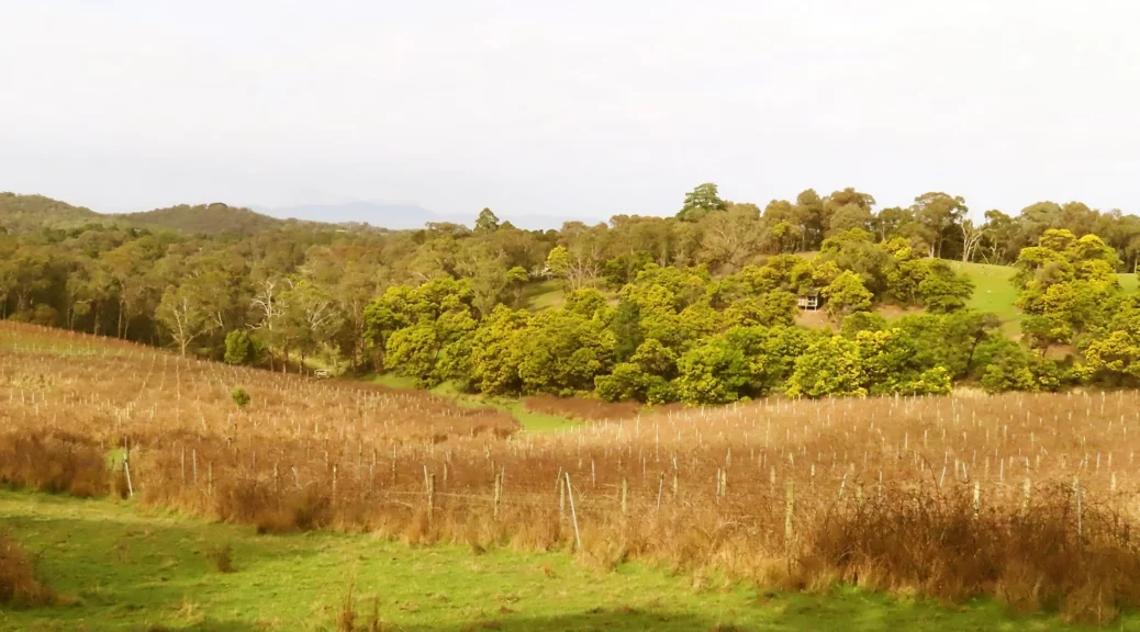
A scenic walk through Panton Hill’s reserve area.
This description is a bit hard to follow and a couple of times we had to back track.
Walking from the car park, on the right-hand side of the bridge, there is a track with signage starting level with the road. Looking for a path at the “base of the bridge” is not helpful.
After some distance, there’s a crossing down a deep creek ford. The text mentions “Howards Road” but you don’t go on it until the return journey. Take Bluehouse Road, which is the vehicle road following the creek down the hill, with the creek on its left. This takes you to Boomers Reserve.
After Boomers Reserve the walk returns you to Bluehouse Road and at the top of the hill is Kangaroo Ground-St Andrews Road. At the main road, turn left, but instead of walking on the road there is a narrow track below the road and is much more pleasant to take than walking next to fast road traffic.
We followed this path for as long as possible, but after some distance walking on the main road is necessary to reach Howards Road.
The whole walk has lovely scenery, so don’t forget to take some moments to look around, even over the main road.
The vineyard along Howards Road is very scenic, but it’s not open to the public like a lot in the area now. There’s a beautifully constructed artist’s studio, adding to the walk atmosphere.
A very pleasant walk to do, which should take under two hours as long as you don’t take too many wrong turns!
Walk Description
From the Eltham Environs Walking Group, walk 52E
Commences at the bridge across New Chum Gully, at the intersection of Long Gully, Broad Acres and Motschalls Roads. Access can be via several roads, with Bakehouse Rd providing a substantial section of sealed surface. Park in an open area adjacent to a large water tank. Walk across the road intersection to the right-hand side of the bridge.
From the base of the bridge, cross a sometimes muddy patch of ground, then follow the narrow track. Wimbi Reserve (not marked) will be on your left. After approx 600 m, a steep section of road leads down to some often muddy pools, and a fire access road (Howards Rd) will be seen rising quite steeply on the left. Stay on the narrow track, on high ground, until the track ends.
At this junction, a track comes in from the right, and a fire access track can be seen entering sharply left. Ignore these, and instead follow Bluehouse Rd by veering slightly left. Yanggai Reserve (not marked) is also on the left. After a short distance, a driveway and road can be seen on your right. Ignore these, instead veering left on the continuation of Bluehouse Rd.
After about 250 m, turn left on to a track that provides entry to Boomers Reserve. Follow this, taking any further tracks in the Reserve that are on your right. In late autumn and early winter, Epacris (Australian heath) is in flower, and with the right conditions provides a fine display. The aim now is to work your way back to Bluehouse Rd.
On reaching Bluehouse Rd, turn left. Just before reaching a T-junction with the main road, which is Kangaroo Ground-St Andrews Rd, look for a narrow track on your left that will return you to Boomers Reserve. This track runs parallel to Kangaroo Ground-St Andrews Road on the south side, and can be used for c500m.
Eventually, a track enters from the left. Ignore this, instead following a grassy track back on to the main road. Use the main road for a further 500 m, then turn left into Howard Rd. Walk past a vineyard on your right, and at the end of the road, descend to cross a muddy section of a creek bed. Ignore the muddy road on the left, and instead climb up onto the bank ahead.
Turn right onto a narrow track – the track used at the beginning of the walk alongside Wimbi Reserve (now on your right) – and return to the cars just beyond the bridge.
The Map
Max elevation: 224 m
Min elevation: 118 m
Total climbing: 1059 m
Total descent: -1057 m


